Wednesday, December 5, 2012
Tuesday, November 20, 2012
Viva la Revolution!
None of us knows the shape of the future. This half-century of disorders teaches us that the future is a secret which is divulged neither in the works of Karl Marx nor in those of his adversaries. But we can say this much to the future which a few impassioned young men are somewhere building: every revolution that stifles criticism, that denies the right to contradict those in power, that prohibits the peaceful substitution of one government for another, is a revolution that defeats itself - is a fraud. My conclusions will irritate many people. No matter: independent thought is almost always unpopular. We must renounce outright the authoritarian tendencies of the revolutionary tradition, especially its Marxist branch. At the same time, we must break up the existing monopolies - whether of the state, of parties, or of private capitalism - and discover forms, new and truly effective forms, of democratic and popular control over political and economic powers and over the information media and education. A plural society, without majorities or minorities: not all of us are happy in my political utopia, but at least all of us are responsible. Above all and before all else: we must conceive viable models of development, models less inhuman, costly, and senseless than those we have now. I have said before that this is an urgent task: the truth is, it is the task of our times. And there is one more thing: the supreme value is not the future but the present. The future is a deceitful time that always says to us, "Not yet," and thus denies us. The future is not the time of love: what man truly wants he wants NOW. Whoever builds a house for the future happiness builds a prison for the present.- The Other Mexico (1972) by Octavio Paz (1914 - 1998)
Sunday, September 23, 2012
Formato #4, Agente #036
I could have SWORN I posted this last time we did our Mexican visa renewals, but can't find it anywhere. My buddy L is doing his MX visa renewal this month, so this goes out to him.
http://www.youtube.com/watch?v=XXWZ3uAEKsw
http://www.youtube.com/watch?v=XXWZ3uAEKsw
Monday, August 20, 2012
When to use a Long Cage vs Short Cage Derailleur? Ask Speedub.Nate
Time to buy a new rear derailler (yes, derailler. I speak English, not French - i.e. "derailleur"). Stoopid rock! Wait, mountains are made of rock. Ok, stupid loose rock with a bad attitude.
So do I need a long, medium or short cage Derailler?
Well no better answer to that question than the one posted by Speedub.Nate on MTBR.com
http://forums.mtbr.com/drivetrain-shifters-derailleurs-cranks/when-use-long-cage-vs-short-cage-derailleur-205890.html
You da man, Speedub.Nate!
Tuesday, May 29, 2012
Back to the Peak and Over the Back
Jeff, Jose, Oliver, Deron and Ginger's
2012-05-26 Hike to the Summit of San Felipe Peak and Beyond
2012-05-26 Hike to the Summit of San Felipe Peak and Beyond
(San Felipe del Agua and San Pablo Etla), Mexico.
Summary:
Starting Location:
5617ft / 1712m, San Felipe del Agua
San Felipe Peak Summit:
10174ft / 3101m
(From GoogleEarth. Actual GPS reading on SF Peak Summit is probably due to margin-of-error)
(From GoogleEarth. Actual GPS reading on SF Peak Summit is probably due to margin-of-error)
Highest elevation obtained:
10174ft / 3101m
(3128m GPS reading on SF Peak Summit is probably margin-of-error)
Hike End Location:
9278ft / 2828m, N17.18065 W96.70014
(i.e. we caught a ride down into San Pablo Etla and then returned to SFdA via auto)
Total Distance Traveled:
35.3miles / 56.8km
(i.e. by foot, truck, collectivo and VW Bug)
Total Hours of Outing:
12 hours, 27 minutes
Total Distance Traveled:
35.3miles / 56.8km
(i.e. by foot, truck, collectivo and VW Bug)
Total Hours of Outing:
12 hours, 27 minutes
Total Distance Hiked:
11.4miles / 18.km (16.8km + 1.6km)
Total Hours of Hiking Portions:
9 hours, 13 minutes (~ 5.25 hours moving: 4 hours stopped)
Total Hiking Ascent: 5492ft / 1674m
Total Hiking Descent: 2011ft / (538 + 75m)
Note: click on pictures to view larger image.
On Saturday, May 26th, 2012 four of us (plus one of Jose's dogs, Ginger) met at 6am to hike to the top of the San Felipe peak via the previously posted Duende Tierra route. Our intention was to then walk east to the fireroads intersection and follow the north/northeast road to see if it went down to San Pablo Etla. Examination of GoogleEarth's satellite images of the area seemed to indicate that it would connect with San Pablo Etla (SPE) as a road labeled as Sin Numero No. 3 (aka Road SN3) in GoogleEarth. That "Possible Rd to Etla?" track was estimated to be about 8miles of steady descent to SPE.
The day was overcast and the sun not yet up when we started. A light rain had fallen earlier in the morning but the ground was more damp than muddy. As the day lightened to show a thick cloud cover that threatened more rain, we hiked to the peak with two or three breaks for snacks. The passage through the Duende Tierra area was especially magical with the air thick with mist. Since there was no rain and the trail was much more well worn and obvious than the last climb in January, we made good time to the false summit (with the gravestone) and on to the true San Felipe Peak summit. It seemed we were above the rain level as it was thick clouds below with an overcast sky, yet no rain on us.....yet. We went onward east over to the cross of yellow pipe (Cruz de la Tubería Amarilla) before continuing east along the ridge to the trails intersection with three fire roads. We turned north down the road assumed to lead to SPE and passed meadows full of flowers as a light rain started. We came upon several road intersections and trails crossing the road. All of the former were well-marked with signs. Almost an hour later (3.7km with 175m descent) a man and his family in a pickup truck overtook us. It had continued to rain and we were thinking of the planned stop for Chinese food near SPE so we asked for a ride.
We rode in the back of the man's truck for 45 minutes (14km and 1130m of descent). Along the way the man stopped at a gate house so we could pay the "entrance" fee to exit the San Pablo Etla "park." We were asked for 30 pesos each but they accepted the 100 peso note we offered for the four of us. We eventually were let out at the SPE Municipal Water District offices (at least that is my attempted translation of the sign) where we discovered that the man driving the truck was the Presidente of San Pablo Etla (i.e. the "Mayor" or jefe grande). We didn't have any reasonable bills to offer him for the ride and he told us not to worry about paying him.
From there we walked for another 30 minutes, heading down the road through SPE to the highway where we eventually got a collectivo to the Chinese restaurant. Imagine the poor girl already in the small Toyota taxi as four sweaty, wet guys and a dog (plus our backpacks) try to cram into the car with her and the driver. After a filling lunch and some beers at Mia Arroz (the Chinese restaurant), Jose's wife came and picked us up in there VW bug. Good thing we got practice packing ourselves into the collectivo. From there it was back to San Felipe del Agua.
Here are some photos and GPS charts from the outing. An interactive GoogleMaps map of the GPS data (via a KMZ file) is located at the bottom of this post.
 |
| Jose and Ginger take a snack on the way to Duende Tierra |
 |
| Snack break #1 for the boys. SF Peak in the clouds on the far right. |
 |
| Oliver approaching Road JRR crossing |
 |
| Jeff approaching Road JRR crossing |
 |
| Oliver at the Road JRR crossing. Time for breakfast break! |
 |
| Ginger, Jose, and Jeff entering Duende Tierra |
 |
| Jeff, Jose, Oliver and Ginger enter Duenda Tierra |
 |
| Rain layer trying to rise up into Duenda Tierra against west side of false summit. |
 |
| Gringo in the maguey patch! |
 |
| Jose in the maguey patch in saddle on sw approach to SFP false summit. |
 |
| Jose and Ginger on gravestone on SFP false summit |
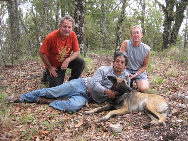 |
| Jeff, Jose, Ginger and Deron on SFP false summit. |
 |
| Clouds over Etla as Jeff and Jose approach the cross of yellow tube |
 |
| Jeff and Jose approaching the cross. |
 |
| View to the SW from Cruz de la Tuberia Amarilla |
 |
| Oliver and Jose at the Cruz de la Tuberia Amarilla |
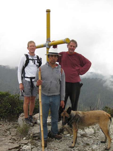 |
| Deron, Jose, Jeff and Ginger at the Cruz de la Tuberia Amarilla. Jose seemingly grumpy about no cute Chinese girls being located. |
 |
| Oliver at the Cruz de la Tuberia Amarilla |
 |
| Jeff at the Cruz de la Tuberia Amarilla |
 |
| Wildflowers in the wetlands near the summit of SFP |
 |
| Oliver and Jose at the end of of the day in San Felipe del Agua |
GPS Data Summary & Elevation Profile (Overall outing):

GPS Data Summary & Elevation Profile (Initial Hike over summit until ride down in truck started):

GPS Data Summary & Elevation Profile (Ride in the truck down to SPE):

GPS Data Summary & Elevation Profile (Hike through SPE to catch collective):

GPS Data Summary & Elevation Profile (Collectivo ride, lunch at Mia Arroz, and ride back to SFdA):

Overall Route of Outing on San Felipe Peak Hike 2 - Satellite View

(Red is route
hiked, pink is taxi ride home):
View Larger Map
Use GoogleMaps to see most of this hike data in full-view, as well as details of waypoints, click here
Or better yet, use (free) GoogleEarth and download the KMZ file for use of ALL the hike data. Click here
for the KMZ data file.
Wednesday, May 23, 2012
Garmin BaseCamp v3 Track Color Codes
Continuing my forehead flattening fun migrating my GPS data in Garmin BaseCamp into a MySQL database to allow for future scripting delights I needed to know the appropriate RGB color codes in hexadecimal for the colors that are assignable to Tracks in BaseCamp version 3. Here is an image of my cheat sheet which would more accurately be named "Garmin Track Colors and their closest match to a Named HTML Colors (along with the RGB hex code)"
 |
Click color table for full-size image.
Wednesday, January 11, 2012
Deron and Meredith’s 2012-01-06 Hike
to the Summit of San Felipe Peak
(San Felipe del Agua, Etla, and
Huayapam), Mexico.
Summary:
Starting Location:
5638ft / 1718m, San Felipe del Agua
San Felipe Peak Summit:
10159ft / 3096m
Highest elevation obtained:
10575ft / 3223m
(explanation in the ramblings below)
Hike End Location:
5685ft / 1732m, Huayapam
(i.e. returned
to SFdA via taxi)
Total Mileage Hiked:
16.5miles
Total Hours of Hiking:
9 hours, 35 minutes
Total Ascent: 6126ft / 1867m
Total Descent: 6089ft / 1856m
Note: click on pictures to view larger image.
Elevation Profile (Hiking part of route only):

Route of D & M on San Felipe Peak
Hike
(Red is route
hiked, pink is taxi ride home):

View Larger Map
Use GoogleMaps to see most of this hike data in full-view, as well as details of waypoints, visit: https://www.google.com/maps/d/edit?mid=zB2kha2APj7g.kQotupOJnzA0&usp=sharing
Or better yet, use (free) GoogleEarth and download the KMZ file for use of ALL the hike data. Click here for the KMZ data file.
Also available on WikiLoc.com: http://en.wikiloc.com/wikiloc/view.do?id=2386694
Meredith and Deron at the San Pablo Etla sign:
(at junction of
Duende Tierra trail & Juarez Ridge (dirt) Road
(see map waypoint “DT + JRR
Jct”))


After we came across the dirt road (JRR) and this sign, we
(mistakenly?) went east on the road until the road died out. At that point we began bushwacking to try to
get back to the top of the ridge (to our north). Once we did, there we found a singletrack
trail right on the ridge. We probably
missed a singletrack cutoff to the northeast as we walked along the road.
But at least we got to see the first of the many large (then
later, HUGE) maguey plants:

Map close-up of our bushwacking section you should avoid. It is just west of the area we think
is Jeff and Oliver’s Duende Tierra. Blue
is probably the actual route one should take.

Here is Mer after we finally cleared the bushwacking and
made it to the strangely-vegetated saddle on the ridge just west of the steep
climb up to the false summit of San Felipe Peak. If we have the right location, this is Jeff
and Oliver’s “Duende Tierra.”

Here is Mer (looking sooooo happy) as we struggle up the
steepest part of the climb – the western approach to the false summit of San
Felipe Peak. Note the amount of fallen pine needles and leaves covering the “trail.”

The “headstone” at the top of the (west) false summit of San Felipe peak:

Deron at the best viewing spot on San Felipe peak, the cross
of yellow pipe, east of the true summit.

Same location (Cruz de la Tuberia Amarilla),looking south
over Oaxaca de Juarez:

After we left the peak, we headed east as we decided we’d
prefer to take the Upper Hauyapam Access Road (Road UHAR) down into town instead of
trying to go down the slippery, steep slope we'd taken up to the peak. While heading east we entered a four-way
intersection (i.e. our trail from the west, three fire roads on the other
compass points). As we were now beyond San Felipe del Agua and mostly north of Huayapam we were surprised to find
another Etla community sign at this intersection. It would
seem the Juarez Ridge Road (Road JRR) has an offshoot that comes around the San Felipe peak on the north
and connects in here.

After following the east fire road (and then a slight
shortcut up a trail henceforth known as Cava Cagarruta (Trail CC) we connected with the
UHAR. Seven miles (down!) and 2.5 hours later we made it to the center of Huayapam.
From there we grabbed a taxi home to San Felipe del Agua. Here is a picture of the church in Huyapam (taken on a previous visit):

Explanation of how maximum elevation
is higher than the San Felipe Peak summit.
Our maximum elevation reached was 10575ft / 3223, reached
NOT at the SF peak summit but instead 0.1 miles east of the CC + UHAR
junction. This is because there is a
higher peak to the north east of this intersection. That peak is 10803ft at its summit and the
UHAR appears to go straight to it (to service the towers on top of it,
probably).

Suggested alternate route for getting
to Duende Tierra with children.
To get to the Duende Tierra area as easy as reasonably possible,
I suggest skipping going up Martillada trail (Trail Ma) to get to Duende Tierra trail (Trail DT) and
instead drive up the Libramiento Norte road (Road LNR) to its summit to the west. From there use High Flyer Ridge trail (Trail HFR) to
connect to the top of the Ma trail and then over to DT trail
before heading up to JRR and then on east to the Duenda Tierra
area. It is probably possible to stay on the ridge on HFR trail and go past the
Ma trail turnoff, instead climbing straight uphill to connect with the
DT trail. See GoogleMaps/GoogleEarth
satellite views for a peek at the vegetation/path you’d be going through. Here is elevation data for using HFR versus
straight up Ma.
Comparison of trail elevations between going up Martillada
(950ft elevation over 1.6 mi) versus driving up Libramiento Norte Road and then
using High Flyer Ridge trail (500 ft elevation gain over 1.7 miles):

Suggestions:
I would recommend NOT using the route we used to get to the
SF Peak summit. Instead I would do it in
reverse, i.e. starting in Huayapam and using the UHAR to get up to the top
before heading west over to the summit of SF Peak. This would mean you’d miss seeing Duende
Tierra area but you will see much of the same strange vegetation as you head up
the UHAR and the road, though very steep, is still better than the west
approach. If it was earlier in the dry
season when perhaps there is less dropped leaves/needles, the west approach may
be more reasonable (though it will be damn steep still). Good luck.
Subscribe to:
Posts (Atom)